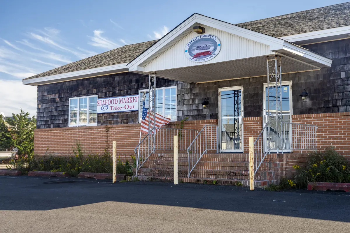
A longtime family-owned fishery could give way to townhouses on Ship Bottom’s most visible corridor as the community continues to navigate roadway changes at the heart of Long Beach Island. The proposal was expected to be heard by the borough land use board at its Oct. 20 meeting.
“Based on the data and traffic analysis in this traffic engineering assessment, the traffic resulting from the proposed residential development will not have a significant impact on the street network,” Shropshire Associates said in its Sept. 3 traffic assessment report.
The traffic report is included with the application package for 902 LBB, LLC’s proposal to build 14 fee-simple townhomes on the one-time Surf City Fishery site near the former Causeway Circle. In New Jersey, a fee-simple townhouse owner owns both the home and the specific lot beneath it – not just the home’s interior, as with a condominium. Townhouse describes the style of home; it does not determine the type of ownership.
The traffic assessment compares the proposal with a hypothetical 24-unit development, which exceeds the 16 units permitted by the site’s zoning, according to the report. Since the property is about 1.01 acres and the maximum permitted density is 16 units per acre, the appropriate comparison is a conforming 16-unit development, according to the assessment.
Among its findings, the report determined restricting the development’s entrance from Long Beach Boulevard to right turns, effectively eliminating left-turn exits, would reduce the impact on traffic compared with existing conditions. Ocean County, which owns and maintains the Boulevard, must approve the driveway’s final location and design.
The traffic assessment also found the proposed development would add about seven trips during both the weekday evening and Saturday midday peak hours, with minimal or no change to intersection operations at the Boulevard or Ninth and 11th Streets.
The Long Beach Boulevard right-in/right-out driveway and the Ninth Street full-movement driveway are projected to operate at a level of service with little to no delays or short delays, according to the report. The assessment balances the impact against a state-defined level of service for roadways.
The approach from 10th Street is projected to remain at the same level of service that is consistent with excessive delays as defined by the state’s threshold for traffic, according to the report.
Long Beach Boulevard runs the length of the Island, from Barnegat Light to Holgate. Near the former fishery, it is a four-lane road, with two lanes in each direction and a center turn lane. Speed limits vary by season, with higher limits in the off-season. Most traffic signals on the Island switch to flashing mode then; the signals at Eighth and Ninth streets remain fully operational.
Ninth Street is part of the Route 72 corridor, the Island’s only road connection to the mainland. Eighth Street serves as the sole route off the Island.
Responsibility for Ship Bottom’s roads is split among three levels of government: the borough controls residential side streets, the state owns Eighth and Ninth streets (Route 72), and Ocean County oversees Barnegat Avenue, Central Avenue and the Boulevard.
In May 2025, the Boulevard and Central Avenue became full north-south roadways near the former Causeway circle. The improvements are part of the final, multiyear phase of the nearly $360 million Causeway expansion and rehabilitation project.
The applicant is proposing seven lots that measure 24 feet by 48 feet and seven that measure 22 feet by 47.1 feet, according to Borough Engineer Frank Little’s review of the application.
The plan calls for separate lots for a shared driveway and swimming pool as well as parking, landscaping, recreation space, fencing and stormwater management improvements.
The proposal provides 35 on-site parking spaces for 14 townhouse units: two spaces per unit, plus seven additional spaces on Lot 1.02, including one accessible space. Borough regulations do not specify parking requirements for townhouse units; state standards require 2.4 spaces for three-bedroom units and do not address four-bedroom units. No-parking is proposed along the internal drive aisle, Little said in his Oct. 9 report.
Last year, Ship Bottom designated three commercial properties as affordable-housing overlay zones under its settlement with the state, opening the door to possible future residential development. One is the former Surf City Fishery, between Eighth and Ninth streets – a location that puts traffic and access squarely in focus as the land use board considers the current townhouse proposal for the site.
Under the borough’s rules, a project with more than five residential units on any of the three properties must set aside 20% of its units as affordable housing, Borough Attorney Tennant Magee explained at the December 2025 council meeting, where the issue was discussed. The other designated sites are Oskar Huber Furniture and Design on Eighth Street and the Bank of America property between 15th and 16th streets, where the Boulevard and Central Avenue meet.