The approval of townhomes at the former Surf City Fishery site marks a visible shift along Ship Bottom’s central corridor as a longstanding commercial property gives way to housing, even as the new owners opt out of affordable housing in the overlay zone.
“Once you lose a commercial site, you’ll never get it back and that’s my concern for this town,” resident Ron Craft said last month before the land use board approved plans for 14 fee-simple townhomes on the 1-acre parcel running from Ninth Street south toward 10th street on the eastside of the Boulevard.
He said the borough may pick up more tax revenue from the units initially, but down the line discretionary money during peak season will be spent outside the confines of Ship Bottom.
“People come here for vacation, and you’re going to send them south to Beach Haven or across the bridge instead of keeping the dollars here in the town of Ship Bottom,” Craft said. “That’s why I’d like to see, again – maybe I am later to the party – this as a mixed use instead of straight residential.”
Prior to the Oct. 21 vote, Chairman Ken Yankowski said the board’s options were limited because the townhomes are a permitted use in the general commercial zone and the borough engineer found no issue with the single variance that was being requested.
The application also complies with the site’s building-coverage limits, he said. Although borough ordinances allow 16 units, the owners plan to build 14 and have opted out of the affordable-housing overlay, reducing density, Yankowski said.
Last year, Ship Bottom designated three commercial properties as affordable-housing overlay zones under its settlement with the state, opening the door to possible future residential development. One is the former Surf City Fishery.
Under the borough’s rules, a project with more than five residential units on any of the three properties must set aside 20% of its units as affordable housing, borough attorney Tennant Magee explained at the December 2025 council meeting, where the issue was discussed. The other designated sites are Oskar Huber Furniture and Design on Eighth Street and the Bank of America property between 15th and 16th streets, where the Boulevard and Central Avenue meet.
Board attorney Joseph Coronato explained that approval would require the applicant, 902 LBB LLC, to pay into an affordable housing fund, which could support housing elsewhere in the borough or be used by the state to fund units elsewhere in New Jersey.
Nicholas Talvacchia, attorney for the applicant at the Surf City Fishery site, said his client would not use the affordable-housing overlay and would sell the townhomes at market rates.
“Less density works better as a design,” he said. “If we wanted to take advantage of the ordinance, we could build 24 units. We wanted the layout to be nice; the units to be wide. We wanted to have room for a swimming pool. It’s going to be a very, very upscale development.”
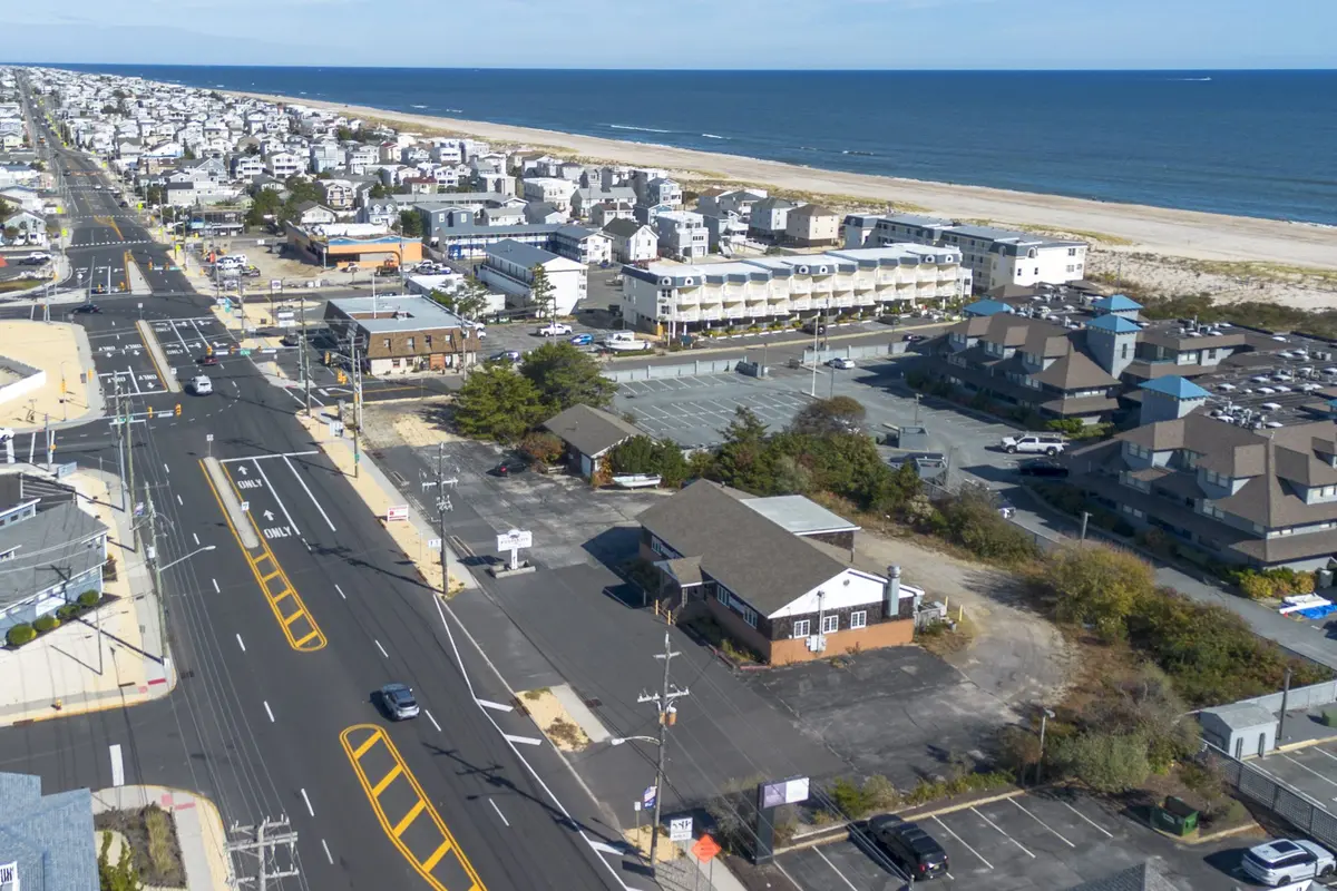
Located near the former Causeway circle, the site is at the epicenter of the Island’s central corridor that sees nearly every vehicle coming on and leaving LBI.
“To do a traffic study, we actually go out and do counts, which we did July 18 and 19. So, we got summer peak activity,” said David Shropshire, the project’s traffic safety expert. “Obviously, what we found was delays in left turns at the area intersections.”
The traffic assessment compares the proposal with a hypothetical 24-unit development (which would have been allowable under affordable housing).
The assessment found that limiting the Long Beach Boulevard entrance to the townhomes to right turns – in effect, preventing left-turn exits –would reduce the project’s traffic impact compared with existing conditions. Ocean County, which owns and maintains the Boulevard, must approve the driveway’s final location and design.
A driver attempting to use the site as a shortcut to make a left turn would likely do so only once because of the delay, Shropshire said. The traffic signal at Ninth Street can mean a wait of at least 60 seconds; it favors traffic on the Boulevard and eastbound traffic, allowing left-turning vehicles 10 seconds or less of green time.
The development is projected to add about seven vehicle trips during both the weekday evening and Saturday midday peak hours. The assessment found that the added traffic would cause little or no change in intersection operations on the Boulevard or at Ninth and 11th streets.
The proposed right-in/right-out driveway on Long Beach Boulevard and the full-movement driveway on Ninth Street are expected to operate with little or no delay, or only short delays. The assessment measures traffic conditions against the state’s roadway level-of-service standards.
Traffic approaching from 10th Street is expected to remain at a level of service the state classifies as excessive delay.
Long Beach Boulevard runs the length of Long Beach Island, from Barnegat Light to Holgate. Near the former fishery, it is a four-lane road with two lanes in each direction and a center turn lane. Speed limits are higher in the off-season, when most Island traffic signals switch to flashing mode. The signals at Eighth and Ninth streets remain fully operational.
Ninth Street is part of Route 72, the Island’s only road connection to the mainland. Eighth Street is the only route off the Island.
Road maintenance in Ship Bottom is divided among three levels of government: the borough maintains residential side streets, the state owns Eighth and Ninth streets, and Ocean County oversees Barnegat Avenue, Central Avenue and the Boulevard.
In May 2025, the Boulevard and Central Avenue became continuous north-south roadways near the former Causeway Circle. The changes were part of the final phase of the nearly $360 million Causeway expansion and rehabilitation project.