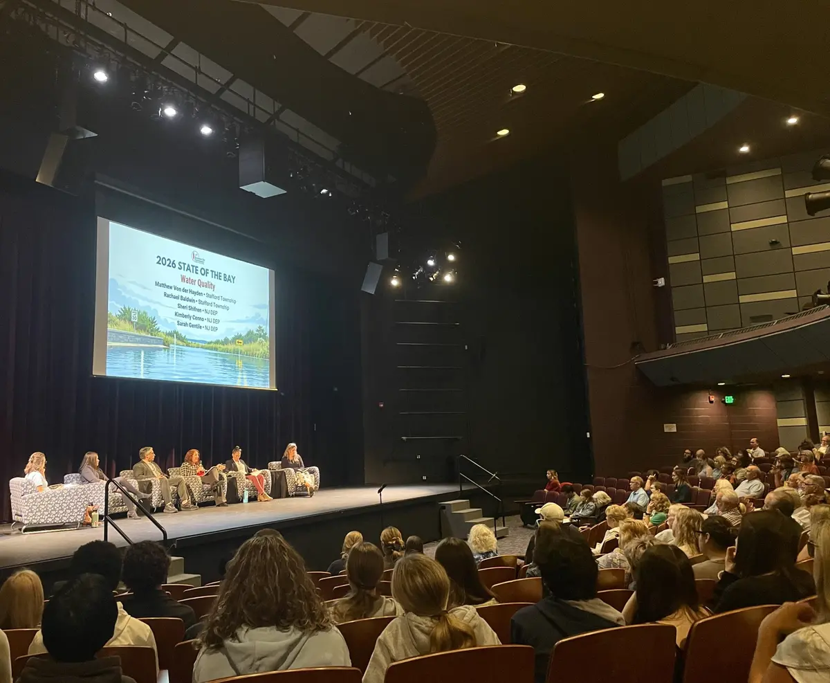
In the wake of the Barnegat Bay Partnership’s release of the 2026 State of the Bay Report – a comprehensive look at the health of the Barnegat Bay estuary and its watershed – the organization held a State of the Bay Symposium at Ocean County College earlier this month. The event brought together experts from throughout the state to inform the public on the most recent advances in the scientific understanding of Barnegat Bay.
BBP Director Andrew McGowan welcomed attendees and emphasized, “It’s our mandate to serve as water-based stewards for the bay.”
As McGowan explained, a State of the Bay Report is released every five years. This year’s report looked at indicators assessed against 2021 targets, “set to primarily hold the line against future degradation,” and, in some cases, to improve conditions.
The 2026 report discusses the status of the BBP’s eight ecosystem-based targets, which represent holistic metrics of the bay’s health. According to the organization, “These targets were established by the Partnership during the creation of the 2021 Comprehensive Conservation and Management Plan, and provided the foundation for the 2021 State of the Bay Report.
“The eight integrated targets were established not only to guard against future loss/degradation but also to work towards restoration and measurable improvements. Broadly, the targets address the water quality of the bay (public swimming beaches, shellfish harvest areas); habitats of the bay (submerged aquatic vegetation extent, wetland acreage, riparian buffers, hard clam populations); and water supplies to the bay (water conservation, ecological flows). Thus, achieving these targets would result in a healthy and resilient bay and watershed.”
At this time, the status of many of the targets is unknown. “Most require bay-wide mapping or assessments, which are both time-consuming and costly,” said the BBP. “Thus, the statuses of targets are updated infrequently. Since the initial creation of targets five years ago, the Partnership committed to and successfully obtained almost $900,000 to update submerged aquatic vegetation extent, riparian buffer and wetland mapping, and to establish ecological flow thresholds. This work is expected to be completed within the next several years.
“While many ‘unknown’ statuses are given in this report, tremendous progress has been made since the targets were established in 2021. For each target in the report, we have provided an update on the progress to date and also identified needed investments.”
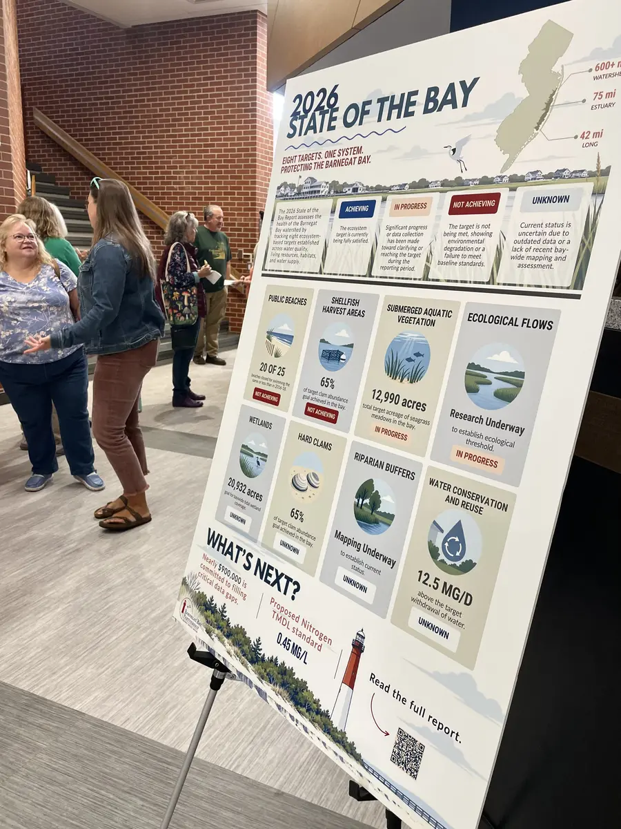
INDICATORS: The BBP’s 2026 State of the Bay Report tracks eight ecosystem-based targets established across water quality, living resources, habitats and water supply.
As McGowan explained during the symposium, shellfish harvest areas are marked as “not achieving” a target, showing environmental degradation or failure to meet baseline standards. The BBP reports, “About 72% of Barnegat Bay waters remain approved for shellfish harvesting, but approved acreage has declined slightly since 2020 rather than increasing toward the target.”
Stormwater is the primary source of contamination, McGowan pointed out. Additional monitoring and bacteria source track-down studies are needed, particularly where stormwater and other nonpoint sources affect shellfish waters.
Public beaches are also “not achieving.” As the organization noted, most monitored beaches are routinely safe for swimming, but five of 25 sites had more frequent bacteria exceedances in 2023-25 than during the 2016-18 baseline. Targeted bacteria track-down studies are needed for the persisent problem areas (none of which listed are in the greater Long Beach Island area).
The wetlands, hard clams, riparian buffers, and water conservation and reuse indicators are all of “unknown” status, meaning the current status is uncertain due to outdated data or a lack of recent bay-wide mapping and assessment.
Updated wetlands mapping, though, is underway. “Meanwhile, 13 acres of salt marsh have been restored since 2020, exceeding the initial 10-acre restoration target, with hundreds of acres of additional projects in progress,” the BBP said. For the future, “continued investment in wetlands mapping, beneficial use of dredged material, living shorelines and larger scale marsh restoration is needed.”
Hard clam abundance is currently unknown because the last comprehensive surveys were conducted in 2011-12. However, partners such as ReClam the Bay have planted more than 7.5 million clams since 2006, and a Hard Clam Fishery Management Plan is being developed.
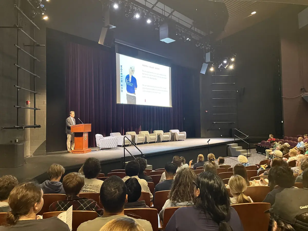
OVERVIEW: BBP Director Andrew McGowan welcomes attendees to the symposium, held at the Grunin Center at Ocean County College.
Regular bay-wide stock assessments, strategic clam planting and better information about harvest, survival and reproduction are needed. According to McGowan, the BBP would like to see the hard clam numbers restored to 1985-86 levels.
For riparian buffers, funding has been secured and mapping is now underway to establish a baseline. In addition, opportunities for buffer enhancement have been identified. The BBP, for the future, wants “continued mapping and restoration … alongside expanded native vegetation and buffers on public and privately-owned waterfront properties. Community champions within the watershed are essential to this success.”
The final “unknown” indicator – water conservation and reuse – has been affected greatly by population growth in the watershed. Water use per person has declined, demonstrating that conservation measures are working, but the population increase has offset much of those savings. Updated withdrawal estimates are still needed to determine whether the overall target is being met. And, for the future, the BBP wants to work toward further reductions in per capita use, expanded water reuse, better tracking of smaller wells and updated U.S. Geological Survey withdrawal estimates.
Two indicators – ecological flows and submerged aquatic vegetation – are listed as “in progress,” meaning significant progress or data collection has been made toward clarifying or reaching the target during the reporting period.
“The first phase of work to establish minimum ecological flows has been completed, and funding has been secured for the remaining phases,” the BBP reports. Ecological flows are the amount of water needed to sustain the diversity of aquatic life and the functioning ecosystem in a river or stream.
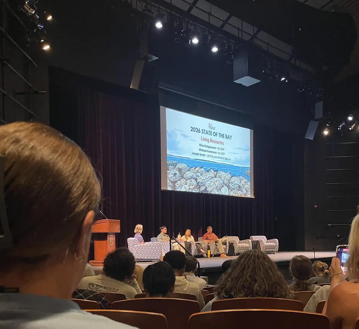
Living Resources Panel Discussion
“Continued research is needed to establish ecological flow thresholds, improve our understanding of groundwater withdrawals and strengthen water conservation,” the group added.
Finally, for submerged aquatic vegetation, a 2026 baywide survey identified 13,546 acres of seagrass – slightly more than the target acreage from 2009. “To maintain the positive trend in acreage,” the BBP explained, “continued reductions in nutrient and sediment inputs are needed. Attention should begin focusing on restoration, which may take years to demonstrate success.”
The symposium also featured three expert-led panel discussions: Matthew von der Hayden and Rachel Baldwin from Stafford Township, along with Sheri Shifren, Kimberly Cenno and Sarah Gentile from the N.J. Department of Environmental Protection, discussed water quality; the DEP’s Nina Colagiovanni and Michael Auriemma, and Joseph Smith from the U.S. Fish and Wildlife Service took questions on living resources such as hard clams, seagrass and salt marshes; and Dan Hoy from the DEP, Rob Karl from the Brick Township Municipal Utilities Authority and Jonathan Kennen from the USGS focused on water supply.
As the BBP explains online, “At its core, the Partnership is a water quality organization. Healthy nutrient concentrations are fundamental to the mission of the Partnership. While there is no specific adopted nutrient reduction target just yet, the soon to be proposed Total Maximum Daily Load (TMDL) of nitrogen represents a culmination of over 15 years of work by the NJDEP, USGS and other partners to establish a nutrient load and water quality criterion.
“Unfortunately, many water quality stations do not meet the new standard, especially those in the northern bay, where more work needs to be done. However, strengthened stormwater regulations and fertilizer laws may already be starting to have an effect: Total nitrogen concentrations have not increased at any station in the bay over the last 10 or more years. Studies in other systems suggest changes in land practices may take a decade or more to manifest in the bay’s waters; thus, no stations getting worse over the past 10 years is an optimistic sign of progress. With the implementation of the TMDL, we’ll hopefully see more progress in the future.
“Just remember: the bay is everyone’s responsibility.”
To read the 2026 State of the Bay Report, visit barnegatbaypartnership.org/2026-state-of-the-bay-report.